


La Baraque de la Buffe au départ du Chazelet

raymondfn
User
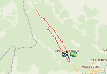

Length
13.8 km

Max alt
2023 m

Uphill gradient
430 m
Km-Effort
19.5 km

Min alt
1742 m

Downhill gradient
429 m
Boucle
Yes
Creation date :
2023-08-18 16:09:22.529
Updated on :
2023-08-18 17:54:01.606
4h26
Difficulty : Very difficult

FREE GPS app for hiking
 SityTrail
IGN / Geographical institutes
SityTrail Plus
The world is yours!
About
Trail Walking of 13.8 km to be discovered at Provence-Alpes-Côte d'Azur, Hautes-Alpes, La Grave. This trail is proposed by raymondfn.


Positioning
Country:
France
Region :
Provence-Alpes-Côte d'Azur
Department/Province :
Hautes-Alpes
Municipality :
La Grave
Location:
Unknown
Start:(Dec)
Start:(UTM)
286050 ; 4992849 (32T) N.
Comments